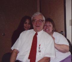
Bob Shepherd with co-workers, 2007
Without teachers who care ~ our past would lose its meaning for the youth AND An enduring salute to all who impart a love of our history to those who will one day be our nation's heirs someone who cared |
Hosted free by tripod.com

by Bob ShepherdMountain man Jedediah Strong Smith is one of the greatest explorers of the West. It is said of him that more than any other, he was the one who "Opened the West." Yet there is a paradox here. Jedediah, or "Diah" -- as his friends called him, was hardly the image of the unkempt and roudy moutain man. He was in fact quiet, Bible-reading Christian, who neither drank nor smoked. Patrick Church says, it was unlikely that a mild, God-fearing man would choose to seek his life's work in so dangerous and arduous a calling as that of mountain man and explorer. Yet "Diah" did exactly that.
Church says that of all the mountain men and explorers of the West, "Only one, Jedediah Smith, was to emerge with achievements ranking with those of Lewis and Clark.
Joe Molter is a contemporary researcher of Jedediah Smith and his travels through California. Using Smith's diaries as his guide, and availing himself of every state of the art tool at his disposal, from topographical maps and computerizations, as well as literally walking in 船iah's footsteps in some instances, he has been able to construct a plausible and no doubt quite accurate charting of the Smith Company's 1828 trek through northern California. This was eighteen years earlier than John C. Fr駑ont's trek through the upper Sacramento Valley, through Cottonwood, and northward.
Early in 1828, loose from the suspicious civil authorities of California, Jedediah traveled up the San Joaquin and Sacramento valleys on his return to the United States. He intended to follow the Buenaventura (Sacramento River) to the great Salt Lake, as it was then thought to flow from. He was leading a cavallard of over 300 head of horses which he had bought cheap in California where they were plentiful. In January he and his men trapped for beaver along the lower tributaries of the San Joaquin. Slowly they worked their way north. They used skin rafts or canoes (bull boats) to cross streams, while the horses swam.
From the vicinity of present day Chico the end of March 1828 Smith recorded the appearance of Mount Shasta, referring to it as "verry high Peaks of the Mountain were seen covered with snow."
Then April 7, Jedediah had two encounters with grizzly bears. This was along present Antelope Creek near Red Bluff. Smith called it "Bear Creek." The first one he got away from by diving into the creek. Later, riding his horse, a grizzly lunged so close the the horse that he grabbed his tail, the horse tugging forward energetically while the bear refused to let go. 船iah recorded that the bear was pulled 40 or 50 yards before he relinquished his hold of the horse's tail.
Still hoping to follow the Buenaventura east and back into the United States, Smith was stymied by the forbidding appearance of the Sierras. North of Red Bluff the mountains come closer and closer to the River, finally pinching off and making travel along the River impossible for the band and their 300 head of horses. East of the River 船iah climbed a high point. Joe Molter says the high point was probably not Tuscan Buttes, as sometimes thought, but rather one closer to the River.
From this high point, 船iah saw that high ranges confronted him not only East, but North as well. But looking to the northwest, he saw a gap between the western hills, roughly where Platina is today. Backtracking southward to just above Red Bluff, Jedediah and his party crossed the River about where present Blue Tent Creek empties into the Sacramento River from the west. Following Blue Tent Creek toward the gap he had seen, Jedediah and party ascended the gradual rise toward the west.
North of Highway 36 is a ridge running parallel to Dry Creek. Smith and his company followed this ridge as it led even higher toward the western mountains. Still traveling west, they went through the valleys where now nestle the towns of Beegum and Platina. Here the moutaineers were confronted by a band of Indians who showered them and their horses with arrows. Attempts to convince the Indians of their friendly intentions failed, and Smith decided to try to frighten them off with a show of arms. It worked, and the Indians fled.
On April 17, they got the horses across the divide to Hayfork Creek in the vicinity of present day Wildwood. Traveling north they eventually passed through present Hayfork, then Hyampom. Hitting the South Fork of the Trinity River, they followed the creek north toward the Main Branch of the Trinity River and the Pacific Ocean. Dale Morgan writes of this part of the trek, and "the extraordinary roughness of the terrain." What's more, they had with them over 300 head of half-wild horses and mules. Morgan writes: "The animals would go through narrow passes in a squirming mass, frantically trying to keep from being precipitated down the vertical cliffs, and inevitably knocking off one or two of their number to be crumpled on the rocks or drowned in the river below; they would get tangled in brush or timber, tied up in cul-de-sacs, their feet, legs, and bodies cruelly mangled by sharp rocks or broken branches; and rarely would they find an open space in which to feed. It was painstakingly slow travel.
By the end of April they were in Hupa (Hoopa) territory, and the Indians were much different from the short-haired, scantily clad peoples of the Central Valley. These folk wore their hair long and dressed in deer-skin clothes. They were somewhat more amenable to dealings with 船iah's men, even offering to trade various items. Following the Trinity River (which 船iah named "Smith River" after himself) they made their way with difficulty to the vicinity of where the town of present Willow Creek, then the Klamath River, and ultimately, through ordeals, through hardships, through interminable coastal fog, and finally through the redwoods, they reached (on June 8) the Pacific Ocean. It was at the mouth of Wilson Creek, near present day Requa.
They reached Rogue River June 27. Ahead of them lay the Umpqua massacre, in which 船iah lost very close to everything. It was Indian revenge for inadvertent maltreatment of a high ranking Kelawetset Indian by 船iah and his men. Somehow 船iah and three other stragglers managed to reach the Fort Vancouver, and the legendary Dr. John McLoughlin, chief factor for the Hudson Bay Company. The Indians called him "White-Headed Eagle" and indeed he must have been majestic looking. Maurice Sullivan describes his towering stature, saying he was "heroically formed, his long white hair falling to his shoulders, he was a tower of strength in the wilderness. It was said there was an unearthly grandeur about him, alike acknowledged by cultured men and barbarians."
See Travels of Jedediah Smith
edited by Maurice S. Sullivan
University of Nebraska Press,
ISBN 0-8032-9206-6

Without teachers who care ~ our past would lose its meaning for the youth AND An enduring salute to all who impart a love of our history to those who will one day be our nation's heirs someone who cared |


last save 12.23.11![]()
friend me (facebook)